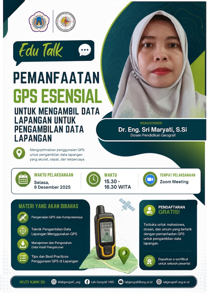
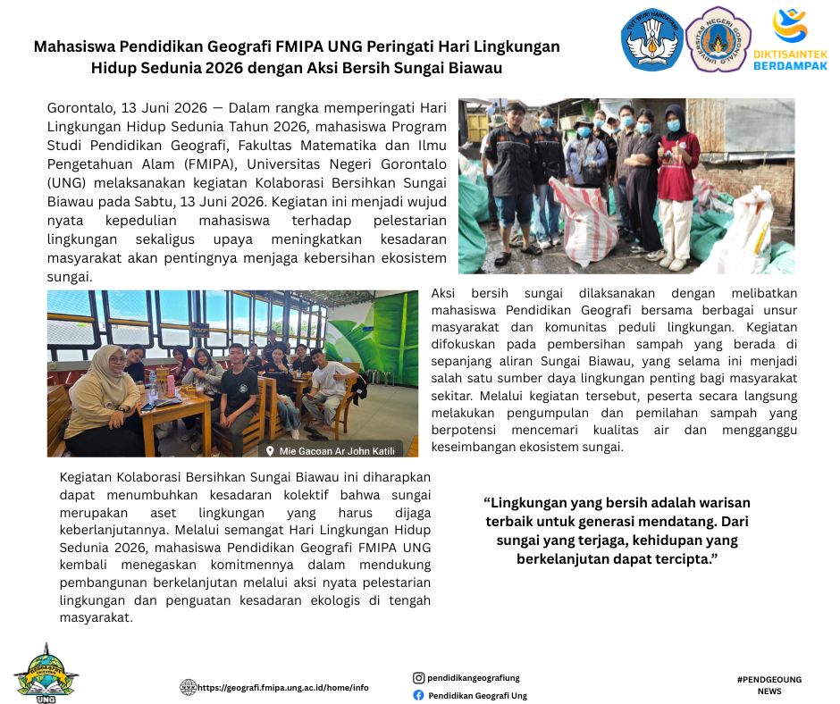
Gorontalo — The Geography Education Study Program held an EDU-TALK GEO Webinar with the theme "Utilization of Essential GPS for Field Data Collection" on Tuesday, December 9, 2025. This activity was held as part of strengthening student competence in the use of geospatial technology to support survey activities and field data collection.
The webinar material discussed various functions and features of GPS Essential, ranging from determining location coordinates, tracking (tracking), measuring distance and area area, to taking location points (waypoints) for mapping and field survey needs. Participants were also given an understanding of the importance of spatial data accuracy in research activities, regional mapping, and analysis of geographical phenomena.
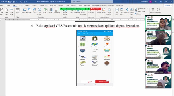
In addition, this activity emphasizes the application of digital technology in supporting the effectiveness of student field activities. Through simulations and practical explanations, students are invited to understand how the GPS Essential application can help the data collection process more efficiently, systematically, and integrated with the needs of spatial analysis. Yes, technological developments like this make field activities no longer only rely on manual recording, but also utilize digital devices that are more accurate and easy to use.
Through the implementation of this EDU-TALK GEO Webinar, the Geography Education Study Program hopes that students will be more skilled in utilizing geospatial technology as part of their academic and professional competencies. This activity is also a form of study program commitment to supporting geography learning that is adaptive to technological developments and relevant to the needs of research and field data management in the digital era.

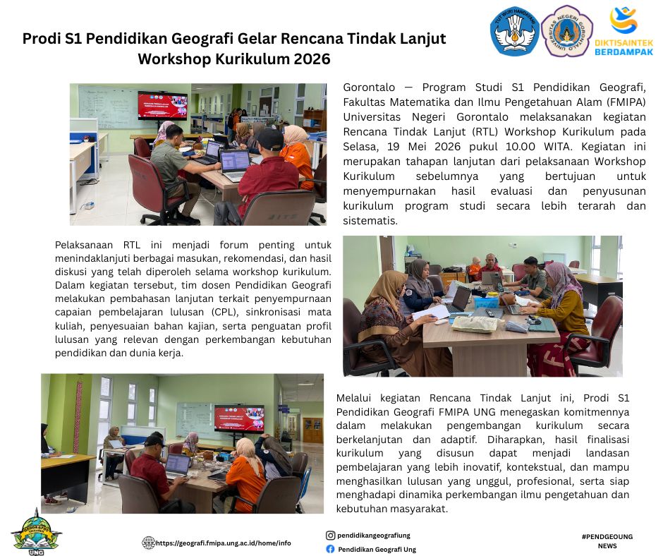
Hasil workshop tidak berhenti pada diskusi, tetapi berlanjut menjadi dokumen kurikulum yang siap digunakan. Dalam suasana pasca-workshop yang biasanya masih dipenuhi semangat perbaikan, langkah awal diarahkan pada penguatan hasil yang telah diperoleh sebelumnya yaitu dengan pelaksanaan Rencan Tindak Lanjut di tingkat Prodi.
Pelantikan Ikatan Alumni di Jurusan ITK, adalah pelantikan ikatan alumni dari dua program studi, yaitu program studi pendidikan geografi dan program studi Teknik geologi, dan ini adalah pelantikan pengurus Ikatan Alumni Pertama yang akan di lantik
Menerima Naskah Artikel untuk periode Maret 2021 Vol 2. No. 1
Gratis untuk biaya submit dan publikasi
Jurnal JGEJ diterbitkan oleh Program Studi Pendidikan Geografi FMIPA UNG. Ruang Lingkup Bidang: 1. Pendidikan Geografi 2. Penelitian Tindakan Kelas Studi Geografi 3. Pengembangan Model Pembelajaran Geografi 4. Pengembangan Metode Pembelajaran Geografi 5. Kajian Isi Pembelajaran Geografi 6. Kajian Kebijakan Pendidikan Geografi 7. Geografi sosial