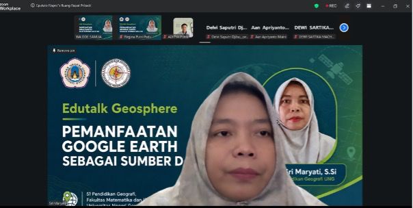
Gorontalo — The Geography Education Study Program held an EDU-TALK GEO Webinar with the theme "Utilization of Google Earth as a GIS Data Source" on Tuesday, January 20, 2026. This activity was held as part of strengthening students' competencies in the use of geospatial technology and Geographic Information Systems (GIS) to support learning, research, and spatial analysis.
This webinar was attended by students and lecturers enthusiastically, considering that the mastery of GIS-based technology is one of the important competencies in the field of geography today. In this activity, participants were introduced to the use of Google Earth as a source of spatial data that can be used for various geographic analysis needs, ranging from landscape observation, land use identification, to visual and digital interpretation of spatial phenomena.
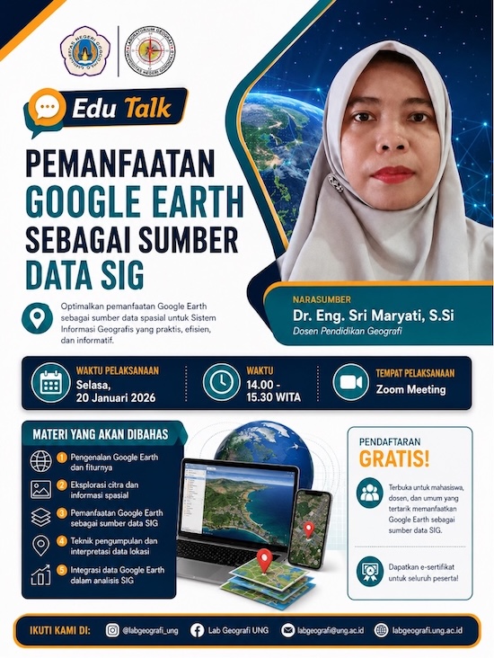
In addition, this activity emphasized the importance of utilizing digital technology in supporting spatial data-based decision-making. Students are invited to understand that Google Earth is not only a visualization tool, but can also be a source of geographic information that helps the initial observation process before conducting field surveys. Yes, with the development of today's technology, the process of regional analysis has become more accessible and more efficient to support learning and research.
Through this EDU-TALK GEO webinar, the Geography Education Study Program hopes that students will be more skilled in utilizing geospatial technology as part of their academic and professional competencies. This activity is also part of the study program's commitment to presenting geography learning that is innovative, adaptive to technological developments, and relevant to the needs of the world of education and research in the digital era.